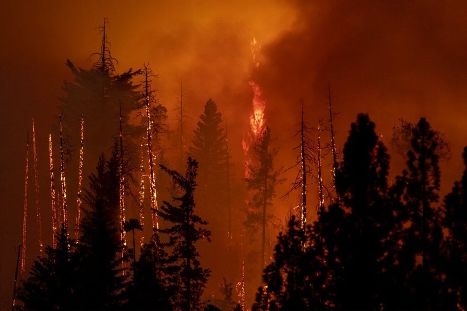
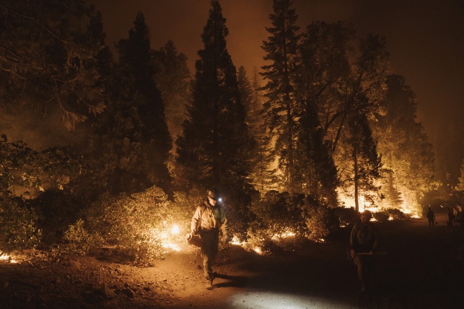
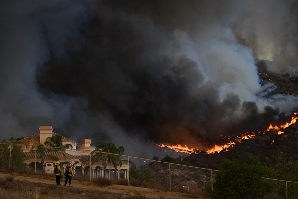
Over half of rural California now ranks "very high" for wildfire risk
Sacramento, California - For the first time, more than half of California’s rural and unincorporated communities could soon be classified as "very high" fire hazard severity zones, according to a proposed map from the California Department of Forestry and Fire Protection.
Officials unveiled the new map – which ranks the likelihood of certain areas to experience wildfire as "very high," "high," or "moderate" – this month and are taking public comments through February.
If approved, nearly 17 million acres will fall under the worst ranking from the Office of the State Fire Marshal, a 14.6% increase since the map was last updated in 2007.
The change is largely a reflection of the state’s worsening fire activity, said Daniel Berlant, Cal Fire’s deputy director of community wildfire preparedness and mitigation. That includes larger, faster, and more frequent blazes, many of which are being fueled by a buildup of vegetation and California’s warming, drying climate.
"That increase really is reflective of what our firefighters have been experiencing over the last several years – more severe wildfires in areas that maybe historically, or decades ago, didn’t have the same susceptibility to wildfires as they do today," Berlant said.
"While the results of the map aren’t necessarily surprising, they really are reflective of a changing climate and an increasing severity of wildfires."
Cal Fire's proposed map shows escalating fire danger in California
The proposed map covers about 31 million acres that are categorized as the State Responsibility Area (SRA), or the area for which the state is responsible for preventing and suppressing wildfires.
The SRA is composed primarily of rural and unincorporated areas and represents about a third of California’s land, Berlant said. It does not include federally managed areas, such as those overseen by the US Forest Service, or cities and large urban areas managed by local governments. Such urban areas will be folded into a second round of map updates next year.
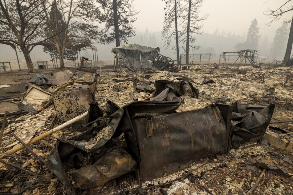
But the findings paint a stark portrait of the escalating danger posed by California’s blazes, which killed nine people this year, primarily in rural communities. The update puts nearly 55% of the state’s SRA acreage into the "very high" category, up from about 48% in 2007.
"In reality, a lot has changed just in the last several years as far as our climate, the severity of wildfires," Berlant said, adding that 2017 was really the year of "defining change."
According to Cal Fire, 12 of the state’s 20 largest blazes on record have happened since that year. The state’s worst-ever fire year, 2020, saw more than 4.3 million acres burned.
Cal Fire map differs from insurance companies' risk mapping in California
Officials said the hazard map is based primarily on physical conditions – such as an area’s topography, vegetation, and previous fire history – and is intended to show the likelihood of fire behavior over a 30- to 50-year period. It is not the same as risk mapping, which is used by insurance companies and can account for short-term efforts such as defensible space clearing and fire-resistant building upgrades.
"Public education about where current wildfire hazards exist is essential to reducing the threat to local communities and maintaining access to affordable insurance," said a statement from Insurance Commissioner Ricardo Lara. "I encourage Californians to ask questions in this public process and to learn more about the tools that exist to help communities and governments reduce their local risks."
Cal Fire said the map could help guide residents’ decisions about where to live and local governments’ decisions about where to build. It will not have direct implications for homeowners insurance, the agency said, although many residents in recent years have reported skyrocketing rates related to worsening fires.
"While insurance companies use similar methodologies to calculate risk as they price their insurance offerings to consumers, insurance risk models also incorporate many factors beyond this process, and many of these factors can change more frequently than those that Cal Fire includes in its hazard mapping," the agency said in a news release.
Insurance Department spokesperson Michael Soller said that California this year became the first state in the nation to require insurance premium discounts for owners of homes and businesses that are made safer from wildfires. The new rules mandate that insurance companies reward consumers who take mitigation actions under the state’s Safer From Wildfires framework, which includes a list of actions that home and businesses owners can take to better protect themselves from fires.
He said updated hazard mapping was also among the recommendations in the agency’s first report on climate insurance, issued last year.
"Really one of the biggest uses is to give people information, whether they’re deciding where to move, or where to build, or where to put local resources into fire breaks and things like that," he said. "We’re on record in terms of continuing to support update mapping. It’s a benefit for the public."
Cal Fire to hold public hearings on the map
The map could have implications for new developments in particular, including factors such as the width of roads, turnaround areas, or spacing between homes. It may also affect property owners, who must provide documentation of defensible space compliance when they sell properties in high or very high fire hazard severity zones in accordance with state law, he said.
Berlant, of Cal Fire, said some of the map’s changes come from improved science, and some areas even saw their hazard levels decrease since 2007. That’s largely because better tools have allowed for more accurate mapping of weather and wind at a local scale, meaning the map is "more fine-tuned and refined to specific canyons and specific county areas, versus the entire portion" of a region, he said.
"That’s really important, especially in areas like Northern California where wind events have really pushed these major fires into cities and caused a lot of destruction, but they’ve not necessarily been regional wind events," Berlant said.
Cal Fire will be holding public hearings on the drafted map in the 56 counties that have State Responsibility Areas until February 3, and the public is invited to weigh in and ask questions. Berlant said officials are particularly interested in scientific input.
Cities and other incorporated areas will undertake a similar process next year and will be added to the map in a second phase of the project, he said.
The final map is expected to be adopted later in 2023.
Cover photo: DAVID MCNEW / AFP