UNESCO verifies war damage to 207 Ukrainian cultural sites
Geneva, Switzerland - Using before-and-after satellite images, the UN has documented the damage or complete destruction of 207 cultural sites in war-torn Ukraine.
The data is being collected on a specially created online platform, which will initially only be accessible to experts but will soon open up to the public, said Krista Pikkat of the UN educational and cultural agency UNESCO in Geneva on Wednesday.
The seven UNESCO World Heritage sites in Ukraine have so far been spared from damage arising as a result of Russia's full-scale invasion eight months ago, she said.
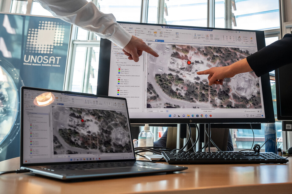
Other locations, like the Mariupol drama theater, have not met the same fate. Hundreds of civilians sought refuge there shortly after the war began in March. On March 16, Russian bombs destroyed much of the building. The images evaluated by UNESCO are from March 9 and May 12.

Of the 207 locations, 88 are religious sites, 15 are museums, 76 are buildings of historical or artistic interest, 18 are monuments, and 10 are libraries.
UNESCO is working with the Geneva-based United Nations Satellite Centre (UNOSAT) for the photo evaluations.
When UNESCO receives information about damage, UNOSAT buys satellite images from commercial vendors taken as close as possible before and after the attack.
According to UNOSAT, such images cost between $251 and more than $1,000, depending on how they are obtained. Experts process the satellite images to show the exact destruction.
The images are used to document the timing of the destruction and the extent, among other things, to make plans for reconstruction, Pikkat said.
Cover photo: Fabrice COFFRINI / AFP