Hurricane Erin quickly intensifies to "catastrophic" category 5 storm in Caribbean
Washington DC - Hurricane Erin on Saturday strengthened to a "catastrophic" Category 5 storm as it barreled towards the Caribbean, with weather officials warning of possible flash floods and landslides.
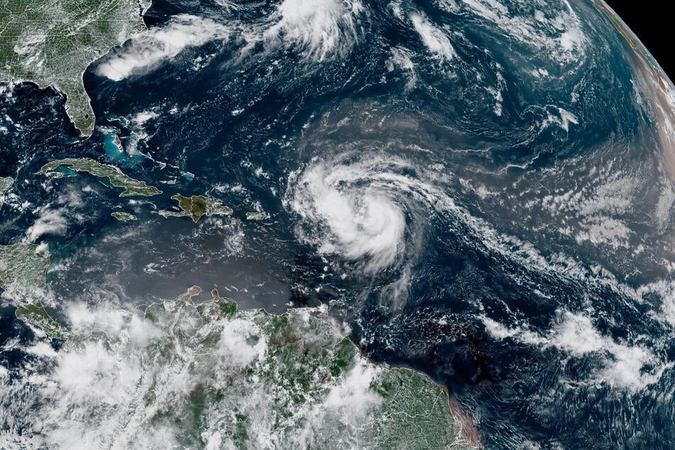
The US National Hurricane Center (NHC) said in its latest report that the storm's maximum sustained winds had increased to 160 miles per hour by 11:20 AM (1520 GMT).
Erin – the first hurricane of the Atlantic season this year – was located about 105 miles northeast of Anguilla in the northern Leeward Islands, an area that includes the US and British Virgin Islands.
"Erin is now a catastrophic Category 5 hurricane," the NHC said.

Tropical storm watches remained in effect for St Martin, St Barthelemy, and Sint Maarten. The hurricane's center is expected to move over the weekend just north of the northern Leeward Islands, the Virgin Islands, and Puerto Rico.
The storm could drench the islands with as much as six inches of rain in isolated areas, the NHC said.
"Continued rapid strengthening is expected today, followed by fluctuations in intensity through the weekend," the agency said in an earlier report.
It also warned of "locally considerable flash and urban flooding, along with landslides or mudslides."
Swells generated by Erin will affect portions of the northern Leeward Islands, Virgin Islands, Puerto Rico, Hispaniola, and the Turks and Caicos Islands through the weekend.
Those swells will spread to the Bahamas, Bermuda, and the US East Coast early next week, creating "life-threatening surf and rip currents," the NHC also said.
The hurricane is forecast to turn northward by late Sunday. While meteorologists have expressed confidence that Erin will remain well off the US coastline, they said the storm could still cause dangerous waves and erosion in places such as North Carolina.
The Atlantic hurricane season, which runs from June until late November, is expected to be more intense than normal, meteorologists predict.
Cover photo: HANDOUT / NOAA / AFP